19 October 2012

Bocachica Revisited

Our group led by our fearless guide on the left!

Last weekend was a holiday weekend (Dia de la Raza, aka Columbus Day in the U.S., was celebrated on the Monday) and the occasion to return to nearby places I'd already been to but wanted to get to know better. San Basilio de Palenque was one place; Bocachica and the Island of Tierrabomba was another.

I really wanted to go for a long hike on the island but at the tourist office was told that wasn't possible. But then I learned that the parents of one of my students was from Bocachica; I told her that I wanted to go on a  l o n g  hike, like from one end of the island to another, and asked her if it could be done. She said of course and arranged for someone to lead us.
Bocachica Foto by Norell

So, 8 of us (3 Colombians, a Colombian-American, 2 Yanks, a Mexican-American, & a German; love the international groups!) met up on Monday morning at 8:30. Of course the trip to Bocachica was only 20 minutes by boat, but for a variety of reasons, we didn't get there til 10:30. This is Colombia! 

Fort San Angel Rafael
We met our guide, German, at his home. He is a native of Bocachica & is involved with an organization that's working to preserve the old Spanish forts & ruins on the island. He was really informative & a very nice guy. There are 1600 people who live on the island in 4 small communities, all very poor. What is happening though of course is that the wealthy (individuals and companies) are buying up some parts of the island & during the course of our day we all of a sudden came across an area where there were luxury homes & hotel like places right on the water. What a contrast. In addition, the Colombian government owns some of the land there & a naval base, currently located on some prime real estate in Cartagena's Bocagrande area, will be moved to the island in the near future.
BATS!! Foto by Norell

German started out by taking us through the town of Bocachica, up a hill to a fort called San Angel Rafael. The fort had a really nice view all around, had been restored about 12 years ago, & had an escape tunnel that led down to the beach! We didn't escape. We entered just the opening of the tunnel and encountered BATS which was kind of creepy, although three of the local girls who followed us in to the fort had no qualms about going through all of the tunnels that we had been a bit nervous about. After enjoying the history & the view, we wandered down to the other fort that I'd already seen during my last trip. I was starting to worry that I wasn't going to see new parts of the island or get my long hike in, despite the fact that German had said a few times "get ready to WALK!" I didn't need to fear...

Blowhole!
Once we left that other fort, we started to really hike. We went all along a black coral bedded coast and passed some other old Spanish defense battery ruins, a blowhole where water at times shoots up to 10 meters high, as well as luxury homes. It did seem a little disconcerting how the luxury homes contrasted with the houses in the villages; it was apparent, too, that the fences built around these homes that reached nearly to the water had blocked off paths that previously had been used by the locals. But the coast was gorgeous....

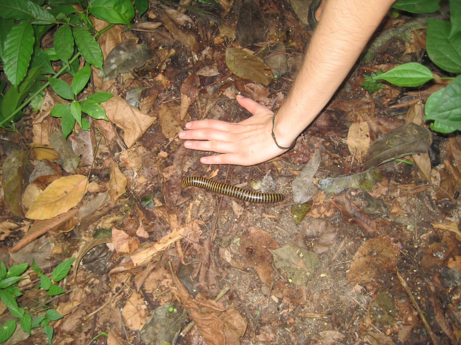
After lunch & a quick dip for some, we started heading inland and up. This is the rainy season on the Caribbean coast, which means that (normally) brief but heavy rainstorms are fairly frequent. We connected with the one road (dirt) that went across the island, which of course was very muddy due to the rains. A few people on motorcycles were coming at us from the other direction and were having a hard time getting through; the smart guy on the burro had no trouble at all though!
We're going to get muddy!

Our goal was another small village on the "Cartagena" side of the island, from which we'd see a view of the city and be able to get a boat back home. We made it there at about 5 pm, 7 hours after we started. One of my fellow hikers from Cartagena said that it was the best hike he'd ever done. We were muddy and sore, but it was really good, beautiful, and interesting. 

From where we had arrived, we had a great view of the Cartagena skyline. In the foreground, just below where we were standing on Tierrabomba Island, you could see the very humble homes that people live in, then came the bay, then the luxury high rises of Cartagena. The discrepancy is always shocking. Wikipedia cites a World Bank study saying that Colombia is "among the most unequal Latin American countries in terms of wealth distribution" and a recent article in the local paper said that the GINI index (which measures wealth inequality) had risen by 10% in Cartagena in the past 16 years. That inequality was glaringly obvious to me this weekend.
Compare: homes in the foreground with those in the background

I got my hike in, but got a lot more too.


For more photos of Bocachica and Tierrabomba Island, click here.

17 October 2012

Back to Palenque for the Drum Festival!

Palenque street (photo:ElUniversal)
I was just back in San Basilio de Palenque! In my other post about this pueblo I mentioned there's a drum festival every October; it was last weekend and I was invited on a day trip with a group from my old Spanish language school. We took an air conditioned van for the hour trip between Cartagena & Palenque--not as adventurous as last time but more comfortable, plus I got to meet a number of new people (mostly travelers), some here for just a few weeks & some for much longer. 


Palenquero sweets
Almost as soon as I stepped out of the group van after we arrived, I ran into a student of mine who'd been in one of my classes for the September cycle & who was from Palenque. It was great to have him tell us about his town and the women of Palenque ("Palenqueras"), who have become symbols of Cartagena. Their becoming Cartagena symbols came about relatively recently & was the result of a lot of struggles by these women. They've traditionally sold fruit & sweets that they carry around in the bowls on their heads, but they were having a hard time being able to do it in the old city of Cartagena. It was only in about 1990 that they were finally given permission to do so, but then there were also certain regulations imposed on hygiene, etc., which all agreed that was not a bad thing, but also they were asked to wear the colorful dresses, which some consider costumes, as they are not a Palenque tradition.
Our lunch cooking outside!

While the homes in Palenque are very humble (many don't have indoor plumbing, have outdoor kitchens and dirt floors), many Palenquero parents work hard so that their children don't have to "work from the bowl", as the women traditionally do, or "work with a machete" in the fields as the men usually do. My student is one of those whose parents have stressed the importance of education; he and his siblings are all pursuing university degrees or have professional careers.


Her hairstyle took about 5 hours to do.
I revisited the parts of the village I'd visited the last time and wandered further on the small streets. We listened to a talk on the various hairstyles of the Palenque women and what they meant--I didn't realize that different hairstyles were worn for different occasions or had different meanings. And I realized they were likely time consuming but didn't think it might take several hours to get your hair done! In addition, there were various dance and music groups performing at various times of the day so we were well entertained & cultured.


Gracias, Ronal!
By not staying overnight, I missed the Sunday morning 4 am wake up call. A colleague said that the whole town was awoken to the beating of drums and everyone gathered to sing. She said it was quite impressive, although I think I was happy to be in my bed in Cartagena!


More photos from the Drum Festival Day in Palenque found here.

23 September 2012

Cannons, Carriages, Chivas, Carts & "Cometas"

The cannons are a great place to hang out!
When I look out of my apartment, I have a direct view to the top of the old city wall. Of course, being the protector of Cartagena, the wall was armed with cannons, some of which are still there. The last part of the wall to be built was called "Las Bóvedas," 23 large vaults originally used to house military while protecting the city, but which are currently nice craft shops. My apartment is not far from Las Bóvedas, a popular tourist destination, and so I often get to hear the clip clop of the horse carriage tours that people take in the walled city; hearing that you could almost imagine what it might have been like when horses were the only mode of transportation. But then along comes the next popular way to tour Cartagena: the Chiva party bus with their music & cheering party people. Sure, I did a "Rumba en Chiva" during the November Parties last year but hmmm....never thought about the people who lived along the route :). Well they end by 10 or 11 so it's not really so bad, and they definitely DO sound like they're having fun!
Clip clopping towards Las Bóvedas

Beyond the clip clopping and the "rumbas", there's a lot more street life to listen to--the fruit & vegetable vendors pushing their carts and calling out their goods and prices (papaya! papaya! a mil a mil a mil a mil!); the newspaper guy telling you what paper he's hawking; the guy pedaling his pedi-cart selling rolls who bangs on the metal top to let you know he's there; there are actually different types of vendors who have different patterns of "banging", but I've yet to successfully differentiate one pattern from another--I need to pay better attention! I do, however, have my basket ready with a rope tied to it. When I hear someone coming by selling what I want, I can now go to the balcony, call down, negotiate the price, pass down my money and bring up my purchase. Haven't done it yet, but I'm prepared!!


Let's go fly a kite!
And it's kite season!! There are tons of "cometas"to be seen out my window recently. There have always been a few but it seems to be more lately. I had noticed them across the wall but it never occurred to me to see where the kite party was really happening til I noticed another friend's blog post about it. So I went out a different way & lo and behold, there was a huge kite party going on! I need to alter my route more so I don't miss out on stuff like this!

More kite flying photos here.

I'm in a horse carriage here!

03 September 2012

At the US Embassy

While visiting friends in Bogota in August, another friend who was coming from Medellin for a long weekend said she was going to the U.S. Embassy while in Bogota to renew her visa. That triggered me to think about my situation & the close proximity to the US Embassy and its services. 

My US passport was due to expire in June 2013, which, yes, was nearly a year away, but I was also living in Cartagena. I was planning to leave Colombia for the December holidays and return via Peru; I would need to have a passport that was valid for at least 6 months upon entering Peru and I would not have that. Yes, I'd be in the U.S., near the nation's capital, for Christmas, but you need 8 weeks to get a passport processed; 2 weeks if you pay the expedited fee. I wasn't sure I was going to have that much time!

So...I went to the US Embassy in Bogota with Martha. For the past I don't know how many years, Colombians have needed tourist visas to travel to almost every country in the world (from what I understand it's because of the history of drug lords, etc; Colombians need special vetting as I'm sure other countries do too for other reasons). A lot of countries require visas, but few require them of U.S. citizens who are coming as tourists. We are lucky. For Colombians going to the U.S., they have to apply in person for their visa at the Embassy in Bogota (no matter where they live) and pay about $200 just for the application. If they are denied, they don't get that money back (& of course have already spent money to travel to Bogota if they don't live there). This is similar for people from other countries who have to apply for a U.S. tourist visa. For Colombians, the visas used to be valid for 5 years, but with the passage of the US-Colombian Free Trade Agreement in May, the tourist visas are now valid for 10 years (multiple entries allowed). A big boon for a lot of Colombians! 
Got myself a new one, with extra pages even!


At the embassy, Martha and I each went our separate ways, to different entrances of the complex. I had a 10:30 appt & was out by 11:15. When I finished, I asked for the rest room, and was led through a secured area and then out to the waiting area where the Colombians are waiting to talk to someone about their tourist visa. Wow, the U.S. citizens don't even have direct access to bathrooms at the U.S. Embassy while Colombians do? I thought we were so inconvenienced! And look, the Colombians get a nice cafe, a little restaurant, ice cream shop (Crepes & Waffles!). Nice! Little did I know....


Martha had an 11:00 appointment, for which she was told to get there by 10:30. When I finished, I went to find her and she hadn't even entered the security gate. I was in & out (& used the bathroom!! :) before she even got in. The Colombians were all lined up outside waiting ("Wait by the black fence")--had it been raining, which happens a lot in Bogota, they would have been soaked. Martha was finally done at 1 pm, 2.5 hours later. They all deserve that cafe and ice cream shop, and more!!

29 August 2012

San Agustin: Number 4

Paco, Barb, Martha, Carlos!
When I first decided to start my "new life" in Cartagena, in learning more about the place so I could tell everyone what I was doing, I learned it was listed as a UNESCO World Heritage Cultural site. As I spent more time in Colombia and traveled, I learned there were other such sites; I visited the second, the Coffee Zone (or "Eje Cafetero"), last New Year's. At Easter time, I visited another: Mompós. I was starting to think that maybe everywhere in Colombia was a UNESCO World Heritage Cultural site and so maybe it didn't mean so much, amazing as these places are. But I've since learned that there are only seven UNESCO World Heritage Cultural sites in Colombia, and, as someone wanting to learn a lot about the country and see the amazing places they have, I just happen to be hitting them.
The park is filled with sculptures & tombs

I hit my fourth in August, when I traveled with friends to San Agustin, in the Huila Department of Colombia. Martha, Carlos, Paco & I took an overnight bus from Bogota to San Agustin, a 525 km/325 mile trip that took 11 hours. The seats on the bus aren't bad, better than economy airplane seats these days. They even show movies (often US ones dubbed in Spanish & then subtitled in English!). Colombian buses have a reputation for "setting the air conditioning to stun" and so hand out blankets for the trip (why not just turn down the AC??? Who knows??!).

Small section of a carved river fountain
In the morning we got to San Agustin, a town of about 40,000 people and is known for it's Stonehenge/ Easter Island like ancient stone carvings & burial grounds. The main focus in the archeological parks there is on people who lived from 3,300 BC to about 800 AD. Not much is known about their lives, but these people left some amazing sculptures & mysteries, such as how did they move these multi-ton slabs around?? I was really impressed by how well-presented the sculptures were in the parks and how well-kept things were in general in this area, a little different from other parks and parts of Colombia that I've seen. 


All those camp years learning to ride for naught :)
The area around San Agustin was beautiful. On our second day there, we visited some archeological sites on horseback. I hadn't been riding since I was about 15 probably. I didn't really need to worry about remembering how to do anything as the horse knows what to do, since he does this same route with tourists several times a week. But I would have liked to have stopped him from galloping off whenever he felt like it (although honestly our whole "pack" would all gallop off at the same time so I'm sure there would have been no stopping my horse!). It rained a bit that morning but it was still gorgeous countryside.


Few sculptures still had colored paint
That afternoon, we drove to a couple of more spots, including the narrowest part of the Magdalena River. The Magdalena is Colombia's principal river, running pretty much the length of the country on the western side. It starts near San Agustin and ends in Barranquilla, just an hour east of Cartagena. There is talk of putting a damn in the Magdalena near where this narrowest part is, which of course some are in favor but many are not....and it is such a gorgeous site it would seem a shame to flood it.

So in less than a year, without really trying, I've been to nearly all of the Colombian UNESCO World Heritage Cultural sites. (In comparison, the US has only 9 and I have only been to only 4 of those, not quite half!) It is a pretty amazing country with a lot to offer, and there are other categories of UNESCO sites to hit here too! I plan to be visit the last Cultural site, Tierradentro, in late November. But before that, I'll be visiting a "wannabe"--one of the sites that's on the "tentative list" for becoming one of these cultural sites--when I do the 4 night/5 day Ciudad Perdida ("Lost City") trek in the Sierra Nevada Mountains of Tayrona National Park.


Rock sculpted on 3 sides overlooking the Magdalena


View of the Magdalena


More photos of San Agustin can be found here (day 1: parks) and here (day 2: horseback riding & Magdalena narrows).

01 August 2012

Travels with Sara 2 -- San Basilio de Palenque


Monument to Benkos Biohó, San Basilio de Palenque founder
Sara arriving in Palenque via mototaxi
I had wanted to visit Palenque, not far from Cartagena, ever since I read a little blurb about it shortly after I arrived here last October. Hard-working "Palenqueras", or women from Palenque, walk around Cartagena in their colorful dresses, selling fruit and sweets which they carry in bowls on their heads, and have become symbols of this city. What was the story of the town they're from?
"Palenques" ("walled cities"), were small towns founded by escaped slaves in the 1600s. San Basilio de Palenque, about 50 km from Cartagena, was the first such town and the only one still in existence in Colombia. Most of the some 3,500 residents are direct descendants of these escaped slaves and they have a unique culture reflective of their African roots, including having their own language.  The town has been recognized by UNESCO as an important cultural space.
Me with Maria & a friend

Sara was all for visiting Palenque and the adventure of getting there. We took a ~45 minute local bus from downtown to the bus terminal, then another ~45 minute bus trip to where the road to Palenque met the major "highway." From there you take a "mototaxi" the ~3 miles to Palenque itself. A mototaxi is a motorcycle that takes a paying passenger; no, it's not a legal business but they are widespread here on the coast. Having seen the mototaxis speeding dangerously through the jam packed streets of Cartagena, I never wanted to take one, but here it was our only option. I asked my helmetless driver for a helmet but there was none to be had. I will say that our drivers drove quite carefully and slowly over the partially paved/partially unpaved road in to Palenque and it wasn't so bad. Still, I don't anticipate taking one anytime soon in Cartagena.
El Maestro in front of his portrait

There are a couple of Palenqueras who work outside of my school & I had asked one, Maria, for advice on how best to visit her town, knowing this would mean we'd end up with a guide, which was fine. She set us up with her daughter (who I didn't realize was only 13, but that's ok...) and had us start out at the "Maestro's" house, an older gentleman who leads a Palenquero musical group that has traveled around the world, which we discovered when we met him. It was interesting, and quite a contrast, to hear him talk about his international travels while we were sitting in the back yard of his very humble home in this town which has only had electricity since the 1970s and where many people don't have running water.

The swimming slash laundry hole
Our guide Liliana showed us the cultural center; the river where many wash their clothes as well as swim; the main square with a statue of the town's founder Benkos Biohó, an escaped slave; the school; boxing area; and then took us to a restaurant where we had lunch. It was all quite interesting, even if there was not really much to see, but such an obviously different type of life. The people there live on agriculture (& Liliana was explaining to us what she learned in school about planting, harvesting, etc), tourism (there is a music festival every October when the town is packed), and the women who sell their fruit & sweets, etc. Such a different life.

 More photos of Palenque here.

25 July 2012

Travels with Sara Part 1: Medellin


At a library donated to a poorer Medellin neighborhood by the Spanish royals

July means a visit from a college friend and the opportunity to travel to Medellin and San Basilio de Palenque, two very different destinations.

At a family meal!
Everyone raves about Medellin, because in a country that is somewhat organizationally challenged, Medellin has it all figured out. Their public transportation system especially is something to brag about and consists not only of a coordinated bus and light rail system, but it has cable cars as a part of the transport as well. The system was purposefully made to connect the poorer neighborhoods with downtown as a way to facilitate people from those areas getting to work. If people from troubled neighborhoods have jobs, life will improve all around in the city. It is simple but ingenious. Medellin's had a troubled past, having been in the middle of Pablo Escobar's "realm", but it's done wonders to pull itself out of that past. While there are still issues, it is a city to be rivaled in Colombia.
"Typical" for the region: Bandeja Paisa

Sara and I met up in Medellin and stayed with friends who are Medellin natives. That is the best way to get to know a place--stay with the locals! Plus we got a bit of Colombian family culture with a great family meal that included a sister, cousin, & brother-in-law. 

Medellin's known as the "city of eternal spring" and is a little cooler than Cartagena, which was a welcome change. Sara and I even got to join in on Medellin's "Ciclovia", where they close many of the downtown streets to car traffic and you can ride, roller blade, walk or run to your heart's content. It was a great way to see the city and get some exercise!


At the Bridge of the West!
We took a day trip to one of the colonial pueblos about 1.5 hours outside the city, Santa Fe de Antioquia. It was a cute little town, but the highlight for us was a trip to the nearby Puente del Occidente, or Bridge of the West. We got there via an enclosed mototaxi (kind of a "tuk tuk") which made it even more fun and our driver gave us the low down on what to expect--the Brooklyn Bridge! Well, he explained that it was built in the late 19th century and designed by Colombian Jose Manuel Villa, who also helped with the design of the Brooklyn Bridge. Not quite NYC, but still very impressive!

Next up, San Basilio de Palenque....


More photos & comments on our trip to Medellin are here.


More photos of & comments on our trip Santa Fe de Antioquia and el Puente de Occidente are here.


27 June 2012

Tayrona!

Linda Michel & I arriving at the waterfall
For the second long weekend in June, a group was going to Tayrona National Park, northeast along the coast just past Santa Marta. I had been here during my 2009 trip for a day and it was beautiful, but a bit more crowded and noisy than how I normally picture a national park. This time I chose a different route starting from a less popular park entrance. Derval and started off with a strenuous 3 hour hike to a lesser known beach, Playa Brava, to spend the night there. It was a beautiful and solitary hike, which was fine except that the trail wasn't always very well marked. If we weren't sure where we were going, we plunked ourselves down for a bit and sooner or later someone (usually carrying a machete--seems almost everyone has one here!) would come along to help us figure out the way.


Great roots!
Playa Brava was definitely less popular and also didn't look quite as luxurious as it seemed in the photos on their website. We were the only guests there but were greeted by a man, woman and her cute, chatty 8 year old girl. We ended up going on a hike with little Linda Michel to a waterfall and spent a nice afternoon. Four more people showed up in the evening and we all enjoyed the great peace and quiet in that beautiful setting.


Entering Pueblito
The next day, Derval and I set out to hike another strenuous route to meet up with the rest of the group at the "popular" beach. We had seen the turn off to this trail on our way down the previous day and were planning to reverse our steps to that point. Our host told us there was a short cut, basically the hypotenuse to meet up with that trail, that would save us quite a bit. We figured it would be great to go a totally new route. He led us to the trail head (really a dry river bed) & told us to go straight until we see the "big tree" and then go left. Really? Turn left at the big tree? We were facing a jungle of big trees! We hoped it would be obvious to us when we saw it but....it wasn't. After a little while we realized we missed our turn and decided to head back all the way to Playa Blanca and take the trail we knew. Only about 10 minutes after we turned around, we saw the Big Tree. We had to search a bit for the "left turn" but ultimately found it & kept on hiking (mostly straight up at that point!). Our first goal was "Pueblito",  where between 460 and 1600 AD approximately 2000 people lived in a village of some 250 structures. Pretty cool. Of course, also in this isolated spot you were able to buy a chilled, ok, at least not *hot*, Coke, Gatorade, etc. I do admire the industriousness of people who will lug a cooler chest and ice to a remote location to sell cold drinks, even if it seems a bit out of place!


A millipede the size of your hand.
Once there, we saw some others who'd come up from Cabo San Juan (where we were meeting the others), telling us it was a really difficult hike. We headed down & it did involve some boulder hopping & climbing but it wasn't really that much harder than what we'd already done. At least on this trail we saw more people; on our previous trail that morning we saw no one. On the trail the day before we saw I think 3-4 people. It's comforting to see people to at least know you're going the right way!! Although we'd been warned of snakes and "tigers", the only animals we really saw were insects--huge millipedes and leaf cutter ants being the most interesting!
The beautiful Tayrona coast

We met up with the others and had lunch at the outdoor restaurant there; then I headed out to the main park entrance while they spent another night in the park. I was ready to leave the "crowded" part of the park and head back "home" to Cartagena!

More photos of Tayrona are here.


14 June 2012

Tolú tolu?


Lindley & Derval in their bicitaxi
Colombia has the most holidays anywhere; I read that someplace although I don't know if it's really true. It does make it a great place to work if there are a lot of 3-day weekends to enjoy. We have two in June and during the first, a couple of us went to Tolú, a coastal destination about 3 hours by bus south of Cartagena.

It's always quite an adventure getting information on buses, schedules & prices here. Depending on who you ask (even people representing the same company) you can get several different answers. When buying your bus tickets at the terminal, you can even try to negotiate down the cost of the ticket. It makes every trip even more of an adventure!

Tolú is known for its bicitaxis (aka rickshaw, velocab, pedicab) and sure enough, as soon as we got off the bus there were several bicitaxis with their drivers (or perhaps I should say pedalers?) waiting to take us to our hostel. The bicitaxis we were in were quiet and subdued and could only take one or two passengers, compared to the ones we saw later that evening which could hold maybe 8-10 people, had colored lights going, music blasting, and some even had videos. Each bicitaxi was trying to outdo the other!

Lindley & I in the mangroves
But before we got to Saturday night, that afternoon we took a local bus to an area known for its scenic canoe rides through the mangroves. When we got off the bus, we were immediately met by a couple of men who wanted to sell us a canoe ride. We had been told it would probably be about 15,000 pesos/person and the guy offered it to us for 30,000 each. We said no way. He then brought us over to a sign advertising their prices, which had various tours at different prices & he said he'd lower the price and give all the tours combined to us for 80,000 for the 3 of us. We said we were willing to pay 15,000 each at which point he said no way, way too low, look at these official prices which are much higher! We then said 60,000 for all 3 & he immediately grinned and said yes. That grin let us know we caved way too easily & we said so--he just laughed and took us down to where the canoes were and pointed to our guide. Later I realized we shouldn't even have been talking to that guy; we should have been dealing directly with the canoe guide & cutting out the middle man. No matter how much experience you think you have & that next time you'll negotiate better, you're never quite totally on the ball….

In the past, this mangrove had been populated by small alligators. However, according to our guide, back 40-50 years ago one could make a lot of money from catching the gators & selling them for their skins, and so they were hunted out. We didn't see much wildlife on our tour but enjoyed a little trip on the water.

Caught in the act!
The next day we booked a trip to the islands, part of the San Bernardo archipelago which in turn is part of the National Park of the Rosario Islands near Cartagena (see 27 May post!). This trip was much nicer than the Playa Blanca/Rosary Island trip in my opinion--less crowded, less touristy, more peaceful. Not exactly an abandoned beach but one could pretend.
-->

More Tolu photos can be found here

03 June 2012

Bocachica...and ghosts??


Last weekend I visited Bocachica with some friends. This is a small village on an island in the Cartagena Bay, just a 15 minute boat ride away. There's a small but nice and uncrowded beach here right next to one of the forts that helped protect Cartagena from the enemy: the French, English, Spanish, and/or pirates, depending on what point of history we're talking about. The San Fernando Fort was built on Terrabomba Island just at the opening of "Boca Chica", or small mouth, through which ships could enter Cartagena Bay from the Caribbean Sea. On a small island on the other side of this passageway, the Battery of San Jose was built. A large, heavy chain was strung between these two structures which was used to impede passage of those they didn't want entering. (There is also "Boca Grande", or big mouth, but that entrance had been blocked at one point accidentally via sunken ships and at another point on purpose in order to more easily protect Cartagena; it is still blocked to large ships.)


This weekend I finally visited the Naval Museum of Cartagena. There is a TON of information there on the history of the Spanish coming and taking over the land; Cartagena as a principal stop on the trade route between the Americas and Spain; Cartagena as a principal slave port for the Americas; and the intricacies of what was going on with the various European crowns, i.e., who was marrying or not marrying whom which caused or stopped the various wars (which also affected what was happening in the New World of course). In addition, they talked about how the fortifications were made, and one of the ingredients in the walls is horse doo doo, how can that be?? And just to add a little spice to the museum visit, it's haunted! I had read about this in the local paper a few months ago and there were displays telling about the different paranormal visitors: there's a ghost who often pushes people down the stairs, a couple who roam the upstairs balcony, a headless pirate who's been seen at the helm of one of the ships, and more. I didn't sense any of them during my visit, but perhaps I should go back at night..... :)

More photos from Bocachica can be seen here.

27 May 2012

Here's mud in your eye!

At the castle
San Felipe Castle viewed from Manga, just outside the old city
I took advantage of my former TNT colleague Frances's weeklong visit to do some things I hadn't done at all or since my initial visit to Cartagena 3 years ago! Not only does Cartagena have a 400 year old wall that encircles the old part of the city, there are also various defensive forts around the city leftover from colonial times. Frances and I visited the famed San Felipe "Castle" where I learned that George Washington's older half-brother Lawrence had been among the British troops that attacked this fort in 1741. He was there as a colonist who had volunteered to fight with the British navy, led by an Admiral Vernon. Later, when Lawrence inherited a Virginia estate, he renamed it Mount Vernon, after this admiral whom he admired. We Yanks now know Mount Vernon as George Washington's plantation home. Funny how surprising connections like this one come up; who would have thought there was a connection between Cartagena and Mount Vernon?

Enjoying a typical lunch at Playa Blanca: fish, coconut rice, & fried plantains
But I digress....back to the fortifications! This castle is readily seen from various points in Cartagena. It truly is impressive all of the huge walls and forts that were built around this city. I'm working on visiting more of them as well as learning more about their history.

We also took a day trip out to the Rosary Islands, a group of 27 islands which apparently from above look like they are linked together like a rosary. It is a protected area with some good snorkeling. We happened to go on the one day in the 6 months of my stay in Cartagena that it was cloudy (and it even rained), so the visibility for the snorkeling could have been better, but still it was good seeing colorful fish, coral, and touching a sea cucumber (icky feeling!!) . We then spent a few hours on a nice beach out in that direction, Playa Blanca, which was jam packed for the three-day weekend. Who knew that so many vendors could be around offering you so many things...jewelry, water, food, there were even "bars" in wheelbarrows; they'd make you a cold drink in nothing flat. Coco Loco, anyone?

Just floating....
The next day was the ultimate in Unique Things to do Around Cartagena: a dip in a mud volcano! The Totumo Mud Volcano is only about a 40 minute trip outside the city but I hadn't yet been; a group of us went and it was pretty surreal. You are literally floating in what they say is an over 2500 foot deep pool of mud. You have the option of getting a brief massage while floating on your back (& then your stomach, keep your face up!) and can then hang out in the "bath" as long as you like. Later, they wipe you down as you get out and then you hop into the lake to get cleaned off, with the help of local women if you like (who are very aggressive in getting you cleaned up, your suit doesn't stay on with them!!).

And I did get mud in my eye. My advice is: don't! (Although the people at the volcano are experienced in helping you get it out should it happen....still, it's sore for a few days!)
We are avatars!
(Which one am I?!)


More photos can be seen here.

13 April 2012

Holy Week in Colombia

Typical La Guajira dwelling with burros out front
Holy smokes, what have I been up to? I know, you've probably all been wondering...it's been so long since my last post! Well, will try to catch you up on the key happenings bit by bit, but for now will tell you about my Holy Week, "Semana Santa", or Easter week, in Colombia. We were originally to work on the Monday & Tuesday that week, but about 10 days prior my school decided to close for the week, as apparently often people travel. We will make up the missed days by adding a few minutes to each class that remains for the 4 week cycle. I decided to take advantage of a last minute full week off.

Desert "toll station"!
I ended up traveling with a few women first to a remote region of northeastern Colombia called La Guajira (gwa-heer-a) on a 3-day organized tour, and then to Mompós, a "town that time forgot" inland from Cartagena, which is famous for its Easter celebration. See this map of our week's route; it's not exact but close enough. As you can see we logged about 1900 km or 1200 miles, and Google Maps calculates it out to be 2.5 days of travel time. You may think that sounds like an error, but with many dirt roads via van, bus & 4WD; a lot of driving through the desert in a 4WD; and a couple of ferry crossings, it may be about right! But it was an experience.

Wayuu gas station, Uribia
La Guajira is largely unvisited and uninhabited but known for its beautiful desert landscape and indigenous people, the largest group being the Wayuu. We spent two nights at a rustic "homestead" like facility with spaces for tents, open-air hammocks (which my traveling partners stayed in; it's a popular sleeping option in Colombia), and small rooms with beds (which I had; guess I'm getting old). A Wayuu family owned the facilities but it was run by an ecotour group, who seemed less keen on expanding the facilities and hosting more people than the Wayuu, for obvious reasons! (But I think the owners won out!) We had fabulous meals of goat, lobster, fish, and chicken, all raised or caught right within feet of the dining area.

Making friends :)
I love the desert and have in recent years been to amazing desert areas in Utah, Arizona, Death Valley, etc., and have had my jaw drop in each place. This was another such area, different, yet beautiful, and having a desert along the coast was breathtakingly gorgeous. The Wayuu live in mud and stick houses, raise goats (which are running all over the place seemingly wild, yet somehow each Wayuu family knows which goat is theirs vs their "neighbor's" and the goats automatically go "home" to their correct corral), fish, some work with tourists such as at our facility, among other things. I don't quite understand how it all works but somehow I think they also have almost a monopoly on dispensing gas in the region, as for cars/trucks. They have "gas stations", really areas with lots of ~20 gallon gas cans, funnels & hoses. In some areas that's the only place you can get gas; there are no conventional gas stations.

At the northernmost point of South America
In driving through the desert, some Wayuu kids also set up "toll" stations; they'd string a rope or chain across a couple of cacti, blocking the road and would also put up blocks so a car couldn't drive around the toll area. You'd have to give them change (about 25c) before they'd drop the rope & let you pass. Amusing in some ways for those of us tourists although it likely gets old for the tour guides driving through the region all the time.

Besides the ever-present goats as well as random donkeys roaming the region, we also saw fabulous birds (including a huge flock of flamingos from a distance), iguanas, and the biggest darn grasshoppers I've ever seen. They were amazingly colorful and the size of a small bird; here's a photo from another's person's blog of one.

Anyway we did a bit of walking, beaching, sand dune running, body surfing, and learning about another region and people of Colombia. It was a quick but great trip!

Sunset, Taroa Sand Dune
From there, I headed with two others to Mompós. Traveling between places when going by land is not always easy, but that is part of the adventure also. Our La Guajira tour was to leave us in Riohacha, the main city of the region, and we planned to overnight in a city between Riohacha and Mompós. However, the last bus to Valledupar, our overnighting point, left Riohacha prior to our return, and so we had planned to get a "colectivo" for the 3 hour trip from Riohacha to Valledupar. A "colectivo" is essentially a shared taxi from one point to another--there's a set price for the full trip and it's divided by 4. If only 3 of you show up and you want to chip in the amount for the 4th (non-existent) person, you can, or you can wait & hope a 4th person shows up. "Colectivos" are normal forms of commuting transport within Cartagena; I was learning they were also normal forms of transportation between oft-traveled cities or towns. We were waiting in the appointed area for a colectivo to Valledupar, when a "real" bus stopped in front of us; someone got out, said he was going to Valledupar & did we want a ride. We agreed on a price and hopped in to the empty bus. He stopped at a few other points along the way and collected more passengers but we had a nice air conditioned bus almost to ourselves and arrived in Valledupar in style & for less than anticipated.
Just behind where I stayed

Contrasting this trip was our van ride the next day from Valledupar to Mompós. I blew this one, but to make a long story short we ended up paying more for a substandard trip--too many people packed in to a van with no AC, a chicken in a box, lots of dust blowing in, the van assistant traveling with our luggage on top of the van, and we, the gringas, paid more than anyone else for the trip. We crossed on a ferry that was really just a few planks hammered together on top of some old boats; we the gringas climbed out of the van while on the short but seemingly perilous crossing while the Colombians still packed in the van wondered why we'd gotten out. Ah well, we made it to Mompós with stories to tell!

Our dubious ferry ride while traveling by van to Mompos
Mompós is a beautiful little town that's worth the (no matter how you do it, as you have to travel dirt roads & take a shady looking ferry) less-than-comfortable trip there. It's very walkable, has beautiful architecture, at night everyone sits outside in their Momposian rocking chairs, and it's also been named a UNESCO World Heritage Site. We had a great meal sitting by the Magdalena River, which is the principal river of Colombia. Mompós used to be an important commercial port on the Magdalena, but then a hundred years ago this branch of the river silted up and transport shifted. Mompós hasn't changed since that shift, keeping its early 20th century feel.

Lunch in Mompos with our new friend Santiago and my student Nubia
That evening we saw our first of the famous Mompós Holy Week processions, which have been going on for over 400 years. They start at 6 pm and end sometime in the wee hours of the morning, having traveled a grand total of what can't be more than a half mile up one street & back another. But they march very slowly, taking one step backwards for every two small steps forward, carrying platforms with statues of various saints, etc., which have been around since colonial times. The Holy Thursday procession features the 12 stations of the cross. The "carriers" are honored by being chosen, but they are also dressed in several layers, all packed together, working hard carrying the heavy platforms; they are well deserving of that honor. The Good Friday procession was similar, with the main platform containing Jesus in an elaborate coffin. There's a 16 second video from that procession here.

Good Friday procession
Our slightly less dubious return ferry on a real bus
While in Mompós, we also took a boat trip along the river to see the birdlife, more iguanas than you can count, and a lone monkey napping in a tree. It's a beautiful little town which deserves another visit; I no longer recall the 8 hour bumpy return bus ride to Cartagena and so may just do it! :)

This weekend the Summit of the Americas is in Cartagena--perhaps I'll run into my friend Barack! Hasta luego!

More photos of La Guajira here; more photos of Mompós here.